Guyana

Geography
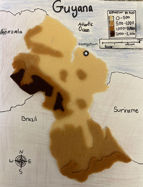
Guyana is located along the Caribbean coast of South America. It is part of the Guyana Shield, an expansive geological formation from Colombia to French Guyana. In total, Guyana is 214,969 square kilometers, making it one of the smallest countries in all of South America. Almost 85 percent of this land is densely forested, with the other 8 percent split between farmland and savanna. This makes it the second most forested country in South America! Guyana has three major regions. First is the Low Coastal Plain. It is quite thin, only 65 kilometers at the widest, but contains 90 percent of the population! This is because the plain has the most fertile farmland in the whole country. Right below the Low Coastal Plains is the Hilly Sand and Clay Region. This area is incredibly dense in mineral resources like bauxite, gold, and even diamonds! These minerals make the Hilly Sand and Clay Region the center of Guyana's mining industry. On the surface, however, it is heavily forested. Last but not least are the Hinterland Forest. They are part of the larger Guianan moist forests. The forest has three major mountain ranges. First are the Pakaraima Mountains. They lie on the border of Guyana and Venezuela. The tallest mountain in Guyana, Mt. Roiama, is located here. Second is the Kaieteur Plateau. It contains the Kaieteur Falls, one of the most powerful waterfalls in the world; 5 times the height of Niagara Falls! Finally, there are the Acaraí Mountains. They are right on the border of Brazil and have many low, wet mountains. Guyana’s climate is subtropical. The temperature is consistent over most of the country. Along the coast, the temperature is warm. In the interior mountains, temperatures vary more throughout the year but are overall similar to the coast.
The Kaieteur Plateau
Maps